Where Is Aruba? Map, Country Status & Is It South America?
Aruba is a small island in the southern Caribbean Sea, sitting about 15 miles (29 km) north of Venezuela as one of the ABC Islands, alongside Bonaire and Curaçao. Is Aruba a country? Not exactly. It's a constituent country within the Kingdom of the Netherlands, which means it governs itself day to day but isn't a fully independent nation. Because it sits so far south, well outside the main Atlantic hurricane belt, it's also one of the more weather-stable spots to build a Caribbean trip around.
I get why the question comes up so often. Aruba doesn't match the mental map most people carry for the Caribbean: it's drier, flatter, and further south than the islands travelers usually picture, and its political status trips up even experienced visitors. Here's what I found once I actually looked closely at where Aruba sits, on the map and within the Kingdom.
Aruba on the Map
Pull up a map of the Caribbean and Aruba is easy to miss if you're scanning the usual cluster of islands near Puerto Rico or the Bahamas. It sits well south and west of that group, roughly at 12.5°N, 70°W, closer to the coast of South America than to most islands travelers associate with the region.
From Venezuela, Aruba is about 15 miles (29 km) offshore, close enough that on a clear day you can sometimes make out the Paraguaná Peninsula from the island's south coast. It sits alongside Bonaire and Curaçao as the ABC Islands, a trio that shares Dutch governance and a noticeably drier climate than the rest of the Caribbean.
That far-south position also puts Aruba outside the main Atlantic hurricane belt, which is one reason it markets itself so heavily as a year-round destination.
If you're flying in, expect roughly 3 hours from Miami and about 4.5 hours from New York, with direct flights on most major carriers during the winter season.
Aruba Is Located in the Southern Caribbean, But Not Where Most People Think
Aruba is part of the Lesser Antilles, specifically within the Leeward Antilles island group, which also includes Curacao and Bonaire, collectively known as the ABC Islands.
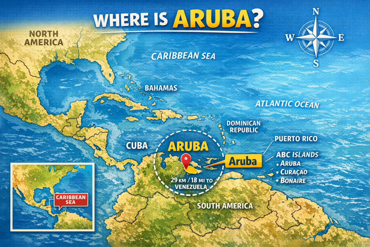 If you look at an Aruba map, you’ll notice something interesting:
It sits far south and west compared to most Caribbean destinations.
It’s north of Venezuela, but significantly south of the main Atlantic hurricane belt.
That positioning changes everything.
Unlike islands in the northern Caribbean like the Bahamas or Jamaica, Aruba enjoys:
- Constant trade winds
- Dry desert-like climate
- Low hurricane risk
- Calm, warm waters of the southern Caribbean
If you read our guide on When Is Hurricane Season in the Caribbean, you already know location matters. Aruba’s geographical position gives it one of the lowest storm risks in the entire Caribbean region.
Is Aruba a Country?
Short answer: Yes, but also no.
Aruba is a constituent country within the Kingdom of the Netherlands.
Let’s break that down.
It is:
- A country within the Kingdom
- A constituent country within the Kingdom of the Netherlands
- One of the constituent countries of the Kingdom, alongside Curacao and Sint Maarten
Aruba gained its separate status within the Kingdom in 1986, when it split from the former Netherlands Antilles.
It is NOT an independent island nation, but it does govern itself internally.
The Dutch monarchy is head of state, but Aruba runs its own:
- Parliament
- Legal system
- Court of Justice of Aruba
- University of Aruba
- Immigration system
So yes, Aruba is part of the Kingdom, but it operates as its own country.
Aruba Is Part of the ABC Islands (And That Matters)
The ABC Islands, Aruba, Bonaire, and Curacao, sit in the waters of the southern Caribbean near the coast of South America.
These islands share:
- Similar dry climate
- Cactus-filled landscapes
- Coral reef systems
- Creole language influences
- Deep Dutch colonial history and culture
But Aruba has its own identity.
While Curacao leans urban and Bonaire leans diver-heavy, Aruba positions itself as the polished, tourism-forward “happy island.”
The Geography: A Tiny Island With Big Presence
Aruba is an island country measuring about 69 square miles. That makes it a tiny island nation compared to places like Cuba or Jamaica.
It sits just above sea level, literally.
Aruba’s highest point is Mount Jamanota in Arikok National Park, located in the northern part of the island.
Geographically, Aruba is:
- Flat on the south and west side of the island
- More rugged and volcanic on the north and east coast
- Surrounded by coral reefs
- Known for dramatic desert-meets-ocean terrain
The island has two very distinct sides:
South and west coast: Calm turquoise waters, white sandy beaches, resort zones
North coast: Wild waves, rocky cliffs, fewer developments
That contrast gives Aruba its personality.
Why Aruba Is Called “One Happy Island”
The phrase “One Happy Island” isn’t just marketing fluff.
Aruba is home to:
- A multilingual local population
- Strong tourism economy
- One of the highest living standards in the Caribbean
- Stable government
- Year-round sunshine
The inhabitants of Aruba speak Dutch and Papiamento (a Creole language), along with English and Spanish.
That multicultural blend shapes Aruba’s vibrant culture and easygoing energy.
If you’ve ever wondered why people describe it as different from other islands in the Caribbean, this is why.
Aruba Is South of the Hurricane Belt (And That’s a Big Deal)
One of the biggest advantages of Aruba’s location is this:
It sits south of the main Atlantic hurricane season impact zone.
Technically, Aruba is part of the Caribbean hurricane belt, but because it is located so far south, near the coast of South America, direct hits are extremely rare.
If you’re planning travel during hurricane season, compare this with our full breakdown in:
👉 When Is Hurricane Season in the Caribbean
You’ll see why Aruba is often considered one of the safest bets during storm months.
What Makes Aruba Different From Other Caribbean Islands?
Aruba is part of the Caribbean region, but culturally and geographically it stands apart.
Here’s how:
1. Desert Climate
Unlike lush rainforest islands like Dominica or Puerto Rico, Aruba has:
- Cacti
- Aloe farms (Aruba aloe is famous)
- Dry terrain
- Minimal rainfall
2. Trade Winds
Constant trade winds cool the island and make watersports ideal.
3. Proximity to South America
Being near the Venezuelan Peninsula influences:
- Food
- Music
- Language
- Trade
4. Compact and Easy to Explore
Because Aruba is small, you can:
- Drive across the island in under an hour
- Visit Arikok National Park in the morning
- Lounge on Eagle Beach in the afternoon
- Catch sunset on the coast of the island without rushing
Aruba’s Beaches: Why Location Shapes the Water
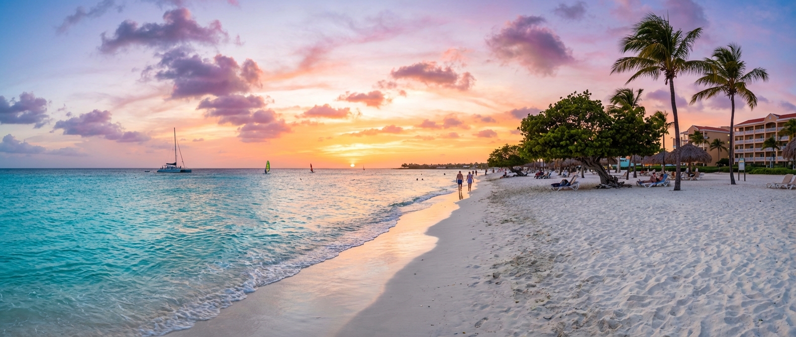
Aruba is home to beautiful white sandy beaches on its western coast.
The waters of the southern Caribbean here are:
- Calm
- Crystal clear
- Protected from major swell
Eagle Beach and Palm Beach sit on the south and west coastline, the calmest side of the island.
Meanwhile, the northern part of the island has rougher waves and fewer swimmers.
That contrast exists because of Aruba’s exact positioning in the Caribbean Sea and wind patterns.
Aruba’s History and Culture
Aruba was once part of the Netherlands Antilles before gaining its separate status within the Kingdom.
Today it operates as a country of Aruba within the Kingdom structure.
Its history blends:
- Indigenous Caquetío heritage
- Spanish colonization
- Dutch governance
- Caribbean Creole identity
You’ll see this reflected in:
- Architecture
- Food
- Festivals
- Music
- Legal system
- Education system
The University of Aruba serves local students and reflects the island’s educational independence.
Why Location Matters When Visiting Aruba
Understanding where Aruba is located helps you plan better.
Because Aruba is south of the hurricane belt, it’s often considered a safer pick during storm season compared to northern Caribbean islands.
Because it’s near South America, flights are easy from North America and Latin America.
Because it’s a constituent country within the Kingdom, travelers from Europe often find it familiar but tropical.
Location shapes:
- Weather
- Culture
- Safety
- Ocean conditions
- Travel seasons
Final Word: Where Is Aruba Located, Really?
Aruba is:
- A Caribbean island located in the southern Caribbean
- North of Venezuela
- Part of the ABC Islands
- A constituent country within the Kingdom of the Netherlands
- South of the main hurricane belt
- Near the coast of South America
- A small island with big tourism energy
It’s not just another dot in the Caribbean Sea.
It’s a strategically positioned, politically unique, culturally layered island country with stable governance, warm waters of the southern Caribbean, and a reputation as one of the happiest destinations in the region.
And now you know exactly where, and what, it is.
Share this Rant:
Frequently Asked Questions
Where is Aruba located exactly?
Aruba is located in the southern Caribbean, just north of Venezuela along the coast of South America. It sits in the Leeward Antilles and is part of the ABC Islands (Aruba, Bonaire, and Curaçao). Unlike many Caribbean islands, Aruba is positioned south of the main hurricane belt, which gives it more stable weather year-round.
Is Aruba part of the United States?
No. Aruba is not part of the United States. It is a constituent country within the Kingdom of the Netherlands. While it governs its own internal affairs, defense and foreign policy are handled by the Kingdom.
Is Aruba part of the Netherlands?
Yes, but not in the way most people think. Aruba is a constituent country within the Kingdom of the Netherlands, meaning it has its own government but remains connected to the Dutch monarchy. It used to be part of the Netherlands Antilles before gaining separate status in 1986.
What island group is Aruba part of?
Aruba belongs to the Lesser Antilles, specifically the Leeward Antilles. It is also grouped with Curaçao and Bonaire as the famous ABC Islands.
How far is Aruba from Venezuela?
Aruba is located approximately 15 to 18 miles north of Venezuela, near the Venezuelan Peninsula of Paraguaná. On a map, you’ll notice Aruba is much closer to South America than to many other Caribbean islands.
Is Aruba in South America?
No, Aruba is not part of South America. It's a Caribbean island sitting on the South American continental shelf, about 15 miles off the coast of Venezuela, but geopolitically it belongs to the Caribbean and the Kingdom of the Netherlands, not to any South American country.
Is Aruba a country?
Aruba is a constituent country within the Kingdom of the Netherlands. It has its own government, currency (the Aruban florin), and self-rule over internal affairs, but it isn't a fully independent nation since defense and foreign policy remain with the Kingdom.
Comments (0)
No comments yet. Be the first to complain.